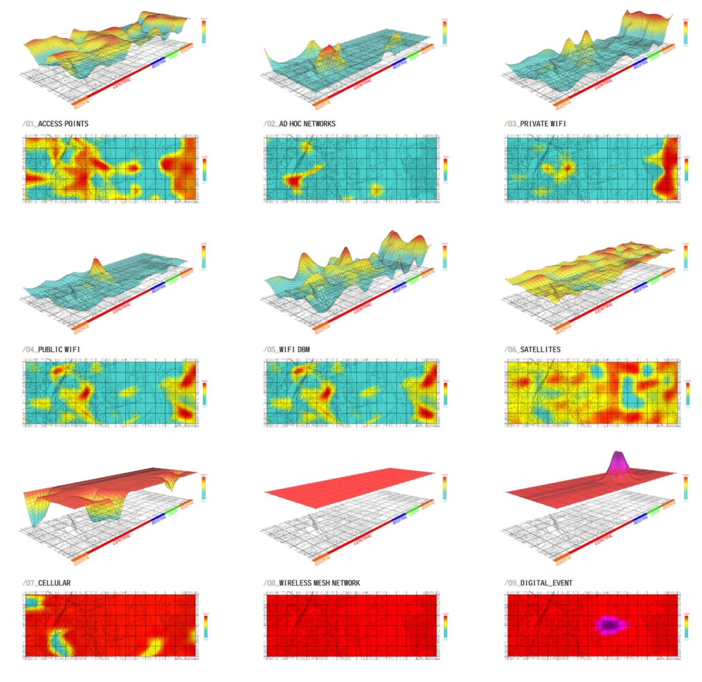
Composite geo-spatial datascapes, in which invisible characteristics of the urban/rural landscape are attached to physical topographical information, have become increasingly prevalent in our attempts to understand the flows and processes that accord further definition of our environment and, indeed, its experiential qualities. This project, developed by Robin Burek, utilised Ordnance Survey grids and the points therein to take a series of data readings in order to determine Wifi signals, 3G and cellular signal strength. By taking GIS readings at each survey point this data was then mapped as a new thermo-terrain within the defined field and superimposed upon one another to create an overall topography of network connectivity. This was in the context of Huddersfield promoting itself as a home for new digital industries. The results were used to inform site selection and programme definition for a masterplan based on sustainable transport infrastructure and integrated urban development.

Is there more information on the method used to develop topography…
Hello Mary,
Not quite sure how to be more explicit. Clearly, any representation is interdependent on the algorithm connected to the data so these topographies could look very different (more dramatic or less contoured) depending on the inherent ‘rules’. This example simply ensure there was consistency in the method for parsing and illustrating the values of signal rather than attempting to present a definitive account. Hope this helps.
Nick